[Conversatorio] Centrales hidroeléctricas en debate: ¿por qué los principales ríos andino-amazónicos no deben ser represados?

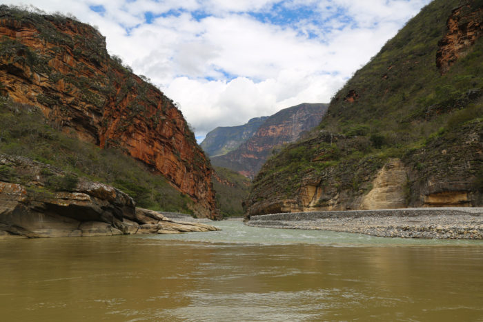
Foto: Cristian Díaz / SPDA

  • Especialistas en conservación y en el sector energético se reunieron para conversar sobre los retos y propuestas de solución para la generación de energía sin afectar la conexión entre los principales ríos que conectan los Andes con la Amazonía.
  • Conversatorio forma parte de El Perú que necesitamos, un ciclo de eventos virtuales organizados por la Sociedad Peruana de Derecho Ambiental que tienen como meta enfrentar los retos ambientales con acciones y políticas públicas concretas.

Este 23 de noviembre se llevó a cabo el conversatorio «Centrales hidroeléctricas en debate», un espacio organizado por la Sociedad Peruana de Derecho Ambiental (SPDA) para conocer las razones por los que los principales ríos andino-amazónicos no deberían ser represados.

Diversos especialistas de la conservación como Bruno Monteferri, director de Conservamos por Naturaleza y Sandra B. Correa, profesora de la Universidad de Mississippi, y del sector energético como Claudio Helfmann, gerente de desarrollo de negocios de Enel Green Power y César Butrón, presidente del Comité de Operación Económica del Sistema Interconectado Nacional (COES) participaron del evento. La moderación estuvo a cargo de Pamela Loli, del equipo de comunicaciones de la SPDA.

Este conversatorio abordó, desde distintos puntos de vista, las problemáticas ambientales y económicas que conlleva la construcción de centrales hidroeléctricas con represas en zonas fluviales y biodiversas, tomando como análisis central el caso de los proyectos Veracruz y Chadín 2 planificados en el río Marañón.

[Lee más: Aprueban moción de protección de ríos amazónicos del Perú en Congreso Mundial de la Naturaleza de UICN]

Una planificación energética sin impactos acumulativos

Bruno Monteferri señaló la importancia de proteger el río Marañón debido a su vulnerabilidad geográfica, ya que se encuentra ubicado en un punto de conexión natural entre los Andes y la Amazonía peruana. Además, alberga bosques únicos, especies endémicas y pinturas rupestres aún no estudiadas.

El especialista agregó que estas megarepresas bloquean el flujo de sedimentos entre el río Marañón y el río Amazonas, provocando la migración de peces y una posible inundación de cientos de comunidades indígenas y ribereñas. También señaló la importancia de tener claro cuáles son los proyectos que ya no cuentan con certificaciones ambientales vigentes.

«Consideramos que desde un punto de vista de transparencia, el registro de Senace debería indicar cuándo las certificaciones ambientales ya no se encuentran vigentes», indicó Bruno Monteferri respecto a los proyectos de megarrepresas en el río Marañón.
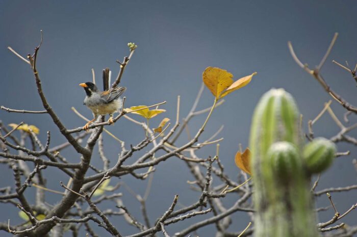
Foto: Walter H. Wust

Sandra B. Correa, profesora de la Universidad de Mississippi, por otro lado, mencionó los riesgos ambientales y sociales que existen al construir este tipo de infraestructuras en ríos con alta importancia en términos de conexión. «El Perú tiene las cabeceras de muchos de los ríos amazónicos de la región, por lo que este tipo de construcciones de represas pueden causar grandes riesgos en términos de conexión», agregó.

Frente a desafíos como una planificación de fuentes de energía más sostenibles en el país, Claudio Helfmann, gerente de desarrollo de negocios en Enel Green Power Perú, señaló que en un contexto de cambio climático es importante apostar por proyectos energéticos con el menor impacto posible en el planeta.

«Nos estamos orientando a energías renovables y con el menor impacto posible en el medio ambiente, por lo que estamos abandonando los grandes proyectos hidroeléctricos», agregó. Además, también indicó que el proyecto Veracruz, pensado en construirse en el Marañón, ya no forma parte de la cartera de proyectos de Enel.

El Perú tiene una demanda de energía cubierta para los próximos años, según Cesar Butrón, presidente del COES, quien señaló la oposición a la construcción de este tipo de infraestructuras en distintos países de la región y el mundo. Además, señaló que «en un contexto en el que la energía social y eólica son más competitivas, las construcciones de centrales hidroeléctricas con represas ya no son una opción«

Para conocer más sobre el caso del río Marañón y de las diversas acciones que se realizan para protegerlo y que sus aguas sigan fluyendo libres, las personas interesadas pueden visitar el especial multimedia www.conservamos.org/rioslibres/

El Perú que necesitamos: Propuestas para una agenda de desarrollo sostenible
Como parte de su 35 aniversario, la Sociedad Peruana de Derecho Ambiental (SPDA) viene desarrollando una serie de encuentros gratuitos enfocados en construir una agenda ambiental para los próximos años. Este evento apunta a generar un debate entre los participantes a fin de sumar ideas enfocadas en mejorar las políticas públicas ambientales necesarias para lograr un país más justo y sostenible.

Las propuestas abarcan diversos temas, desde bosques, fauna silvestre, justicia ambiental, pesca sostenible y territorios indígenas. Además de estos encuentros, se presentarán dos documentales.

La inscripción a las conferencias es gratuita a través de https://spda.org.pe/elperuquenecesitamos

Transmisión completa en el Facebook de la SPDA

Este conversatorio puede encontrarse completo en la página de Facebook de la SPDA, así como también en el canal de Youtube.https://www.actualidadambiental.pe/conversatorio-centrales-hidroelectricas-debate-rios-andino-amazonicos-represas-peru-necesitamos/

Rocky Contos: El Río Marañon

By: Rocky Contos

Leer la historia de Rocky Santos abajo.
Photo by Rocky Contos
The Marañon River (Río Marañon) is the hydrological source of the Amazon River and flows through a canyon comparable in many ways to the Grand Canyon of the Colorado in Arizona. It is literally a dream river for raft support trips, making it accessible to people with and without whitewater kayaking or rafting skills. Due to its unique status as the source of the biggest river in the world and its other outstanding attributes, the Marañon is the most precious river in Latin America and worth every minute of conservation effort to protect it from a series of 20 hydroelectric dams that are planned along the river. The construction of these dams would be one of the greatest environmental tragedies in human history – of the same magnitude as damming the Colorado in the Grand Canyon or Three Gorges on the Yangtze. We need to take action to stop the dam plans on the Marañon!!  Save Río Marañon!!

There are many parallels between South America’s Marañon and North America’s Colorado through the Grand Canyon. Both rivers offer a spectacular combination of whitewater, natural scenery, expansive camps, interesting hikes, and a sense of adventure for recreational paddlers who long to immerse themselves in nature for several weeks. Both rivers contain clean water and steep canyon walls with striking rock formations, and give the river traveler a sensation of being transported back in time. The more than 22,000 people who are lucky enough to paddle the Colorado through the Grand Canyon each year cannot help but marvel at the story of John Wesley Powell and his crew, who explored the region in 1869 in wooden oarboats, and be saddened about the loss of the lower part of the Grand Canyon to Lake Mead. Current-day appreciation for the Colorado as a natural treasure has fostered opposition to and eventual blocking of several additional dams that were planned within the Grand Canyon in the latter part of the 20th century, a major victory for environmentalists.

The Marañon as it now exists offers paddlers the feeling that boaters must have experienced on the Colorado before it came to be controlled and destroyed by Glen Canyon and Hoover Dams. It also offers Peruvians living along its banks a way of life that they have come to love and depend upon, and are in danger of losing forever.
https://www.internationalrivers.org/sites/default/files/styles/left/public/images/resource/kate_ross/maranonsigmimageoriginal.jpg
Rocky Contos beside The Marañon River
Photo by Rocky Contos


Our 2012 trip down the entire Río Marañon was prompted by a desire to descend the entire Amazon River from source to sea and also to experience what appeared to be a Grand Canyon-type trip in South America.  I first surmised that Río Marañon might be one of the finest rafting rivers in the world during the 1990s when I started searching for unknown river gems in Latin America by perusing maps in atlases. Although I noticed many long rivers, only a few possibly could meet “Grand Canyon” criteria: free-flowing, clean, deep undeveloped canyon, high volume, interesting hikes/sites, a long class III-IV raftable section (>300 km), and few or no portages. While many rivers in Latin America meet many of these criteria, almost none meet them all. For instance, Mexico’s Río Grande de Santiago and Peru’s Río Mantaro are polluted and have dams. Chiapas’ Río Grijalva and Chile’s Bio Bio are clean, but now have dams. Peru’s Río Apurimac is too difficult with too many portages. However, one river did appear to meet all the criteria: Peru’s Río Marañon. I wanted to explore Río Marañon and see for myself if it really was a “Grand Canyon”.

Organizing and planning the month-long expedition took a lot of work – getting maps and analyzing them, figuring out how to get a raft and kayaks to the river, shopping for food and other items, and finding partners. I was able to secure nearly an entire set of topographic maps of Peru, which I used to analyze the Marañon and other rivers in the country. Interestingly, during this exercise I happened to make a major discovery of where the most distant source of the Amazon was located (a result soon to be published). My Amazon source discovery does not change the fact that Río Marañon is still the hydrological source of the Amazon – that is, where the majority of water originates. Traditionally, hydrological sources of rivers were generally recognized by geographers and the public. For example, the source of the Mississippi is considered to be in Minnesota at Lake Itasca rather than up the Missouri River – and is named as such. The Blue Nile was often considered the source of the Nile (contributing the bulk of water), even though the White Nile extended farther upstream.  And even Río Marañon was considered the source of the Amazon for over 2 centuries. Nowadays, both “most distant” and “hydrological” sources may be recognized.  Although I descended the Amazon from the new farthest upstream source that I had identified (in a separate month-long expedition), I still wanted to paddle the entire Marañon, which has just as much a claim to the “source of the Amazon” title.

My partners for the expedition ended being my wife Barbara Conboy and two kayakers (Mike Doktor and Amie Begg). On July 1, 2012, we began our 664 km (412-mile) month-long Marañon raft journey by Puente Copuma just upstream of the Río Puchka confluence.  Although it was the middle of the dry season and the river was low, there was still plenty of water and it was quite raftable. In fact, I later realized that after a few more tributaries entered the river, Río Marañon averages about the same flow rate as the Colorado through the Grand Canyon.

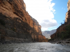
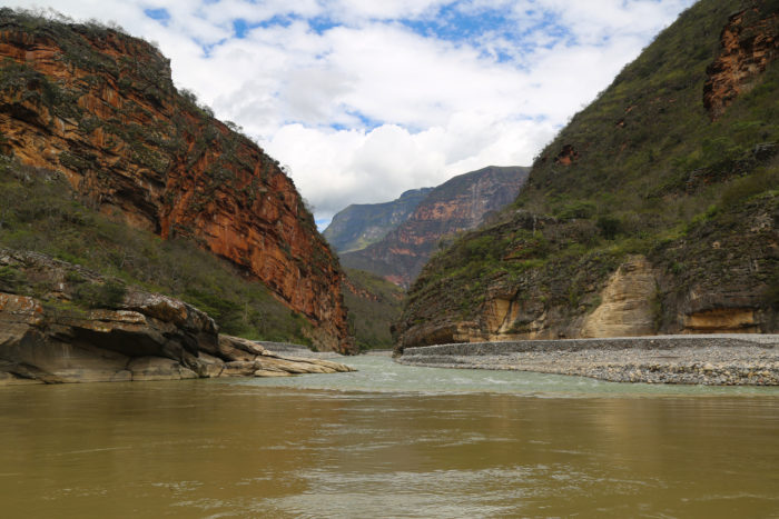
We were all taken aback by the amazingly scenic canyon at the put-in  – a canyon that continued downstream for nearly the entire trip. Vertical red dirt and limestone walls rose directly from the river in places with interesting layered geology in others. High walls in the canyon towered over 3000 m (10000 ft) above the river – and on both sides a times. We passed tributaries entering the Marañon with warm turquoise-colored water depositing travertine.  We stopped to hike into slot side canyons, most with waterfalls creating secluded grottos. We enjoyed soaking in 95oF hot springs about a week into the trip. We camped on expansive beaches and cooked over fires every night with the abundant firewood present everywhere.
The Marañon River at Sunset
Photo by Rocky Contos
The air was usually crisp, clear, dry and hot during the day, with nights comfortably cool – overall, just about perfect weather.  Surprisingly, we seemed to be in a desert at our put-in, something that only became more apparent farther downstream. Aside from a little green riparian vegetation with mango trees and banana plants in places, the flora was brown, dry and sparse, making hikes easy. Cacti abounded, sometimes up to 8 m high and similar to the stately saguaros of the American Southwest. As a testament to the desert-like climate, on our initial 25 days of the trip, we had only two light daytime sprinkles of rain!

The whitewater on the river was challenging, fun, and comparable to that of the Grand Canyon. Although most of the Marañon had been paddled previously, little had been written about it, so our trip involved a lot of eager anticipation of what might be coming up next. In general, we found class III and IV rapids along most of the river, but two class Vs in the initial section down to Chagual (“Wasson’s Landslide” and “Yamara”) incited at least as many butterflies in our stomachs as Lava Falls and Crystal did on the Colorado River. Yet many days of our trip also were quite relaxed – with only class II rapids in sections downstream of Chagual and near Bagua – or in layover camps.

People we met living along the river were generally friendly to us, especially after they learned we were not dam survey crews. On day 5 we met Francisco and Leonardo, two professors who had come down to the river from the village of Quiches to document what was going to be lost with a Korean-financed dam soon to be constructed on the river.  They wanted to photograph some Incan ruins and landmarks that would be drowned by the planned reservoir.  When I asked when the reservoir was to be constructed, they replied, “next year”.  Although I had read a little bit about some dams planned for the jungle sections of the river, this was the first I had heard of plans to dam the upper river. Our new friends wanted to organize opposition, but it seemed like a hopeless battle.


Photo by Rocky Contos
On day 11, in the section after Chagual, we passed some homemade balsa rafts on the side of the river and guys panning for gold with a little dredging machinery.  We were near the village of Calemar, so I reminisced of the stories told by Ciro Alegría in his novel, “La Serpiente del Oro”, written in 1935 about this same village. In it, he described the balseros from the village, their struggles in daily life, and the beauty of their customs. The book was a bestseller and is considered one of the most iconic books of Peru – a classic still read by many students throughout South America. Yet the life described by Alegría, still experienced by many of the residents living along this section of the Marañon, may soon come to an end if the intended giant dams are constructed, destroying the river for centuries.

A little past Balsas, on day 18, we stopped on the left side of the river where some folks mentioned that there were Incan ruins. Walking up a wash and then over to a ranch house, we found its owner, Wilson, and his brother. The brothers graciously showed us around the dozens of Incan stone structures with pottery sherds and bones scattered near them. They then led us up the hill to a small cave area where one of Wilson’s sons had found an entire human skeleton only a year before. After our tour of the area, Wilson gave us a few papayas and showed us the recently completed environmental impact statement (EIS) of the planned 175 m Chadin2 dam, with consequent reservoir that would drown Wilson’s property. If this plan goes through, Wilson and his family will be forced to relocate and most of the nearby Incan ruins – never excavated or studied by archeologists – will be flooded and lost. Although Wilson and his family are opposed to the dam, they don’t know how to stop it.

In the village of Mendán, which we arrived at on day 20 of our trip, we heard that residents were hostile to the dam survey crews who had come down the river on rafts as recently as a month before. Every time we approached folks along the river, we waved to them and made a point of stopping and talking to them, to let them know that we were not a dam survey crew, but rather wanted to help the folks along the river in their efforts to oppose the dams from being constructed. Usually after that, we were greeted quite warmly. We heard tales of their struggles for existence, and how the government was planning to relocate the villages to less fertile grounds – without much compensation. The residents of the banks of the Marañon want to do as much as possible to stop the dams, and have been looking for ways to mobilize their opposition.


Photo by Rocky Contos
Down near the village of Lonya Grande, which we arrived at on day 23, we spoke to a woman who was about to ferry a load of bananas across the river. She mentioned how a meeting was planned in Cajamarca to oppose the 168 m Veracruz dam that would flood her property, but the day the meeting was to be held, the government ordered a blockade of the roads to thwart it. She related how dam company officials had called meetings of the residents in the past, offering free food and other treats to get the residents to sign forms – without informing them of what the forms actually stated. Many residents who had limited literacy signed the forms in earnest, convinced that what they had been told was the truth. Apparently, the forms were designed to get the residents to release rights to property along the river, be relocated, and allow the dam construction to proceed.

The final days of our trip on the Marañon were spent in the Amazon jungle, where the river passes by Aguaruna communities living along the riverbanks. The Aguaruna tribe has inhabited this region since antiquity, and has recently organized vociferous opposition to some exploitative plans for economic development. One well-known incident occurred in June 2009, when a group of Aguaruna travelled to Bagua to block a road in order to oppose a petroleum-drilling project planned in their territory. The ensuing conflict resulted in more than two dozens of deaths of national police force members and an unknown number of deaths of Aguaruna tribe members. This event has led many residents of the Bagua area, upstream of the Aguaruna settlements, to fear the Aguaruna people. A pair of brothers (Noe and Ernesto Piedra) from the small town of El Mullo, on the bank of the Marañon just downstream of Bagua, offered to accompany us on our raft farther into the jungle, and Eusebio Chumpi and son from an Aguaruna settlement a few miles downstream agreed to join our group so that they could talk to the people who lined up along the river banks as we passed.  Yet all these folks we talked to, including the members of the Aguaruna community, were not aware of the plan to put in three massive mega-dams at sacred places like the Pongos de Manseriche, Escuprebaga, and Rentema.  When I mentioned it to them, they were appalled. It just goes to show the need to inform folks about what may be in store for their future: stagnant reservoirs, forced relocations, and ecological disaster.   

Once we reached the village of Imacita on day 28, regular passenger boat service was available to downstream towns all the way to Iquitos. Amie and Mike had already departed, so Barb and I sent our raft back to Lima and continued the rest of the way on our own. In Santa Maria de Nieva, we met, a sociologist from the Aguaruna community named Segundo Valera Wajuyat, who told us about his plans to help lead his people in sustainable eco-tourism. We learned about President Ollanta Humala’s establishment of an Indigenous Congress in Lima to give people like the Aguaruna a voice in national politics. We wondered how we could assist our new friends in Quiches, Chagual, Calemar, Balsas, Mendán, Lonya Grande, El Mullo, and Nieva in their quest to preserve and improve their ways of life.

After making it through the Pongo de Manseriche – the Marañon’s final gorge in the Andes – we spent our final days on the Marañon cruising to Iquitos. We took in the jungle life by exploring the Pacaya-Samiria reserve by canoe and visiting indigenous tribes near Iquitos. Yet we still reminisced about the immense beauty of the desert Amazon canyons upstream. The Marañon had incited in us a desire to help the residents protect this amazing natural resource from misguided attempts at modernization. At the end of our journey down the hydrological source of the Amazon, I only yearned to return, introduce others to this Grand Canyon of South America, and help the river’s residents stop the 20 destructive dams from being constructed.
More information: 
Read more about Río Marañon and the planned dams at the SierraRios website. See for yourself how magnificent this Grand Canyon of South America is by joining a raft-support trip on Río Marañon.  Two to four-week trips are tentatively scheduled for October 2013 and January 2014.  Kayakers, rafters, and passengers are welcome: no experience is necessary as a passenger/paddler on rafts.
See more photos from Rocky’s trip along the Río Marañon in our Flickr set.
Latest additions:
New Maps Project Potential Flooded Areas of Dams in the Marañón River basin
Río Marañon: The Grand Canyon of South America

https://www.internationalrivers.org/es/resources/rocky-contos-el-r%C3%ADo-mara%C3%B1on-7852